
Kategorie:Karten
Nur erstmal angelegt, damit man die Karten wiederfindet
Unterkategorien
Diese Kategorie enthält die folgenden 4 Unterkategorien (4 insgesamt):
Medien in der Kategorie „Karten“
Folgende 200 Dateien sind in dieser Kategorie, von 257 insgesamt.
(vorherige Seite) (nächste Seite)-
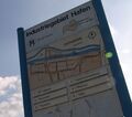
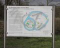 076 burg mark infotafel.jpg 800 × 643; 279 KB
-
-
 Abt. Westfalen, Kartensammlung A, Nr. 12390 Grundriss Agneskirche Hamm.jpg 640 × 1.008; 119 KB
-

-
 Abt. Westfalen, Kartensammlung A, Nr. 1589 Hamm und Umgebung 1925.jpg 714 × 598; 263 KB
-
 Abt. Westfalen, Kartensammlung A, Nr. 1590 Hamm und Umgebung 1924-1925.jpg 1.414 × 1.302; 473 KB
-

-
 Abt. Westfalen, Kartensammlung A, Nr. 1594 Hamm Stadtplan 1925.jpg 770 × 465; 189 KB
-
 Abt. Westfalen, Kartensammlung A, Nr. 20463 Haus am Markt.jpg 481 × 507; 85 KB
-
 Abt. Westfalen, Kartensammlung A, Nr. 20696 Schule in Rhynern.jpg 1.042 × 765; 183 KB
-
-

-

-
 Abt. Westfalen, Kartensammlung A, Nr. 20979 Schulhaus für Nordherringen.jpg 1.058 × 738; 158 KB
-
 Abt. Westfalen, Kartensammlung A, Nr. 20980 Schulhaus für Nordherringen.jpg 1.707 × 840; 228 KB
-

-
 Abt. Westfalen, Kartensammlung A, Nr. 3529 evangelische Westschule.jpg 1.025 × 503; 157 KB
-
 Abt. Westfalen, Kartensammlung A, Nr. 3531 Städtischer Kindergarten Hamm.jpg 1.243 × 671; 310 KB
-
 Abt. Westfalen, Kartensammlung A, Nr. 3807 Mühle in Uentrop.jpg 944 × 648; 144 KB
-
 Abt. Westfalen, Kartensammlung A, Nr. 3808 Mühle Heessen.jpg 2.824 × 1.716; 851 KB
-
 Abt. Westfalen, Kartensammlung A, Nr. 5514 Mühle am Beverbach.jpg 783 × 602; 105 KB
-
 Abt. Westfalen, Kartensammlung A, Nr. 5787 Ahsewehr am Westentor.jpg 470 × 607; 64 KB
-
 Abt. Westfalen, Kartensammlung A, Nr. 5788 Ahsewehr am Westentor.jpg 708 × 997; 134 KB
-
 Abt. Westfalen, Kartensammlung A, Nr. 5789 Ahsewehr am Westentor.jpg 674 × 667; 75 KB
-
 Abt. Westfalen, Kartensammlung A, Nr. 5790 Ahsewehr am Westentor.jpg 391 × 550; 39 KB
-
 Abt. Westfalen, Kartensammlung A, Nr. 5791 Ahsewehr am Westentor.jpg 841 × 1.073; 131 KB
-
 Abt. Westfalen, Kartensammlung A, Nr. 5792 Ahsewehr am Westentor.jpg 475 × 670; 59 KB
-
 Abt. Westfalen, Kartensammlung A, Nr. 5793 Ahsewehr am Westentor.jpg 638 × 590; 88 KB
-
 Abt. Westfalen, Kartensammlung A, Nr. 5794 Ahsewehr am Westentor.jpg 450 × 630; 71 KB
-
 Abt. Westfalen, Kartensammlung A, Nr. 5815 Isenbeck Stauwerkanlage.jpg 853 × 747; 122 KB
-
 Abt. Westfalen, Kartensammlung A, Nr. 5816 Isenbeck Stauwerkanlage.jpg 1.258 × 768; 192 KB
-

-
 Abt. Westfalen, Kartensammlung A, Nr. 6398 Isenbeck.jpg 955 × 678; 174 KB
-
 Abt. Westfalen, Kartensammlung A, Nr. 6412 Mühlenkanal und Lippe in Werries.jpg 1.020 × 664; 205 KB
-
 Abt. Westfalen, Kartensammlung A, Nr. 6417 Mühle in Werries.jpg 1.366 × 672; 223 KB
-

-

-
 Abt. Westfalen, Kartensammlung A, Nr. 6728 Marienhospital.jpg 601 × 660; 110 KB
-
 Abt. Westfalen, Kartensammlung A, Nr. 6729 Marienhospital.jpg 464 × 508; 91 KB
-
 Abt. Westfalen, Kartensammlung A, Nr. 6730 Marienhospital.jpg 762 × 623; 146 KB
-
 Abt. Westfalen, Kartensammlung A, Nr. 6731 obere Hälfte - Marienhospital .jpg 1.102 × 595; 233 KB
-
 Abt. Westfalen, Kartensammlung A, Nr. 6731 untere Hälfte - Marienhospital.jpg 1.237 × 671; 301 KB
-
 Abt. Westfalen, Kartensammlung A, Nr. 6732 Marienhospital.jpg 814 × 603; 143 KB
-
 Abt. Westfalen, Kartensammlung A, Nr. 6734 Marienhospital.jpg 617 × 454; 87 KB
-
 Abt. Westfalen, Kartensammlung A, Nr. 6735 Marienhospital.jpg 510 × 357; 63 KB
-
 Abt. Westfalen, Kartensammlung A, Nr. 6736 Marienhospital.jpg 605 × 637; 106 KB
-
 Abt. Westfalen, Kartensammlung A, Nr. 6856 Heidemühle.jpg 1.006 × 721; 179 KB
-
 Abt. Westfalen, Kartensammlung A, Nr. 7358 einige Besitzungen des Klosters Kentrop.jpg 3.057 × 1.921; 1,33 MB
-
 Bataille de Willinghausen Schlacht bei Vellinghausen.jpg 689 × 700; 130 KB
-
 BI Weetfeld01.jpg 800 × 533; 153 KB
-
 Buergerbus Sued Linienweg 2023.jpg 780 × 1.024; 63 KB
-
 Datteln-Hamm-Kanal-Karte.png 2.672 × 906; 1,2 MB
-
 DGK Grendelmeer.png 1.024 × 470; 22 KB
-
 Erlebensraum Lippeaue (2022)-8.jpg 2.000 × 1.125; 911 KB
-
 Erzstrasse1914.jpg 300 × 210; 16 KB
-
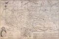
 Grafschaft Mark.jpg 2.033 × 1.800; 1,32 MB
-
 Grafschaft-Mark.jpg 540 × 480; 56 KB
-
 Hafen Industriegebiet.jpg 2.352 × 2.082; 292 KB
-
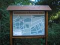
 Haltestellenplan AST Rhynern.jpg 889 × 580; 73 KB
-
 Hamm 1799.jpg 540 × 359; 35 KB
-
 Hamm 1829.jpg 540 × 402; 31 KB
-
 Heessener-Wald 01.jpg 800 × 600; 370 KB
-
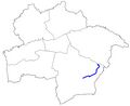
 Karte Ahse.jpg 800 × 656; 69 KB
-
 Karte Barbecke (Bach).jpg 800 × 656; 66 KB
-
 Karte Beringsbach.jpg 800 × 656; 68 KB
-
 Karte Beverbach.jpg 800 × 656; 67 KB
-
 Karte Bewerbach.jpg 800 × 656; 70 KB
-
 Karte bockum.jpg 164 × 130; 5 KB
-
 Karte Böningsgraben.jpg 800 × 656; 64 KB
-
 Karte Dienebach.jpg 800 × 656; 66 KB
-
 Karte Elefant Alleecenter.jpg 500 × 250; 30 KB
-
 Karte Elefant Edel.jpg 500 × 250; 52 KB
-
 Karte Elefant Gehle.jpg 500 × 250; 27 KB
-
 Karte Elefant Hafen Musterstrasse.jpg 500 × 250; 36 KB
-
 Karte Elefant Hannig.jpg 500 × 250; 19 KB
-
 Karte Elefant Immofant.jpg 500 × 250; 83 KB
-
 Karte Elefant Ingo.jpg 500 × 250; 59 KB
-
 Karte Elefant Kinderklinik.jpg 500 × 250; 29 KB
-
 Karte Elefant Kleine.jpg 500 × 250; 18 KB
-
 Karte Elefant Kremers.jpg 500 × 250; 29 KB
-
 Karte Elefant Krietemeyer.jpg 500 × 250; 83 KB
-
 Karte Elefant Kump.jpg 500 × 250; 57 KB
-
 Karte Elefant Lebenshilfe.jpg 500 × 250; 53 KB
-
 Karte Elefant Lippewelle 1.jpg 500 × 250; 19 KB
-
 Karte Elefant Lippewelle 2.jpg 500 × 250; 20 KB
-
 Karte Elefant Maximare.jpg 500 × 250; 34 KB
-
 Karte Elefant Maxipark-Arena.jpg 500 × 250; 19 KB
-
 Karte Elefant MGH.jpg 500 × 250; 29 KB
-
 Karte Elefant Oases.jpg 500 × 250; 23 KB
-
 Karte Elefant Occusus.jpg 500 × 250; 27 KB
-
 Karte Elefant OLG.jpg 500 × 250; 32 KB
-
 Karte Elefant Orthofant.jpg 500 × 250; 18 KB
-
 Karte Elefant Pharao.jpg 500 × 250; 26 KB
-
 Karte Elefant Rhenus.jpg 500 × 250; 25 KB
-
 Karte Elefant Roemerstrasse.jpg 500 × 250; 53 KB
-
 Karte Elefant SRH.jpg 500 × 250; 53 KB
-
 Karte Elefant Steel.jpg 500 × 250; 21 KB
-
 Karte Elefant Tierpark.jpg 500 × 250; 32 KB
-
 Karte Elefant Volksbank.jpg 500 × 250; 24 KB
-
 Karte Elefant WA.jpg 500 × 250; 33 KB
-
 Karte Elefant Wabufant.jpg 500 × 250; 24 KB
-
 Karte Elefant Wasserturme.jpg 500 × 250; 10 KB
-
 Karte Elefant WDI.jpg 500 × 250; 64 KB
-
 Karte Elefant Werler Str.jpg 500 × 250; 19 KB
-
 Karte Elefant Wiggerich.jpg 500 × 250; 18 KB
-
 Karte Elefant Wilhelm.jpg 500 × 250; 104 KB
-
 Karte Elefant Willy-Brandt-Platz.jpg 500 × 250; 28 KB
-
 Karte Elefanten WW.jpg 500 × 250; 18 KB
-
 Karte Enniger Bach.jpg 800 × 656; 68 KB
-
 Karte Erlenbach (Bockum-Hövel).jpg 800 × 656; 65 KB
-
 Karte Erlenbach (Sandbochum) 1.jpg 800 × 656; 51 KB
-
 Karte Erlenbach (Sandbochum) 2.jpg 800 × 656; 51 KB
-
 Karte Erlenbach (Uentrop).jpg 800 × 656; 65 KB
-
 Karte Eversbach.jpg 800 × 656; 65 KB
-
 Karte fehlt.jpg 164 × 130; 3 KB
-
 Karte Frielicker Graben.jpg 800 × 656; 66 KB
-
 Karte Fuhrbach.jpg 800 × 656; 68 KB
-
 Karte Geinegge (Bach).jpg 800 × 656; 69 KB
-
 Karte Geithe (Bach).jpg 800 × 656; 69 KB
-
 Karte Geithe-Bach.jpg 800 × 656; 65 KB
-
 Karte Grabenweg 1957.jpg 300 × 200; 55 KB
-
 Karte Hahnenbach.jpg 800 × 656; 65 KB
-
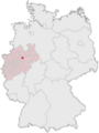
 Karte Hamm Umfeld.jpg 529 × 346; 304 KB
-
 Karte Hamm.png 145 × 193; 18 KB
-
 Karte heessen.jpg 164 × 130; 5 KB
-
 Karte Heessener Schlossgraben Verlängerung.jpg 800 × 656; 65 KB
-
 Karte Heessener Schlossgraben.jpg 800 × 656; 66 KB
-
 Karte Heidbach.jpg 800 × 656; 65 KB
-
 Karte Heidebach (Bach).jpg 800 × 656; 66 KB
-
 Karte herringen.jpg 164 × 130; 5 KB
-
 Karte Hoppeibach.jpg 800 × 656; 66 KB
-
 Karte Huffelbach.jpg 800 × 656; 66 KB
-
 Karte Hölterbach.jpg 800 × 656; 67 KB
-
 Karte Hüsergraben.jpg 800 × 656; 64 KB
-
 Karte Katzenbach.jpg 800 × 656; 65 KB
-
 Karte Kirchgraben.jpg 800 × 656; 67 KB
-
 Karte Kuhlbach.jpg 800 × 656; 66 KB
-
 Karte Lakebach.jpg 800 × 656; 65 KB
-
 Karte Lausbach.jpg 800 × 656; 67 KB
-
 Karte Lippe.jpg 800 × 656; 76 KB
-
 Karte Luisengraben.jpg 800 × 656; 65 KB
-
 Karte Mattenbecke (Bach).jpg 800 × 656; 67 KB
-
 Karte Merschhovener Graben.jpg 800 × 656; 65 KB
-
 Karte Mesenbach.jpg 800 × 656; 67 KB
-
 Karte mitte.jpg 164 × 130; 5 KB
-
 Karte Munne.jpg 800 × 656; 66 KB
-
 Karte Munnebach.jpg 800 × 656; 66 KB
-
 Karte Mühlbach (Herringen).jpg 800 × 656; 66 KB
-
 Karte Mühlbach (Rhynern).jpg 800 × 656; 67 KB
-
 Karte Mühlenbach.jpg 800 × 656; 65 KB
-
 Karte Neustädter Bach.jpg 800 × 656; 66 KB
-
 Karte Niedervöhdebach.jpg 800 × 656; 66 KB
-
 Karte Obere Rothe.jpg 800 × 656; 67 KB
-
 Karte Ostheidegraben.jpg 800 × 656; 64 KB
-
 Karte pelkum.jpg 164 × 130; 6 KB
-
 Karte Pelkumer Bach Verbindungsgraben.jpg 800 × 656; 66 KB
-
 Karte Pelkumer Bach.jpg 800 × 656; 67 KB
-
 Karte Pendelbach.jpg 800 × 656; 65 KB
-
 Karte Rehbach.jpg 800 × 656; 65 KB
-
 Karte rhynern.jpg 164 × 130; 6 KB
-
 Karte Rhynerscher Bach.jpg 800 × 656; 65 KB
-
 Karte Salzbach.jpg 800 × 656; 65 KB
-
 Karte Schmiesbach.jpg 800 × 656; 66 KB
-
 Karte Selbach.jpg 800 × 656; 67 KB
-
 Karte Seseke (Osterflierich).jpg 800 × 656; 66 KB
-
 Karte Seseke (Rhynern).jpg 800 × 656; 65 KB
-
 Karte Spierkuhle.jpg 800 × 656; 66 KB
-
 Karte Südbecke.jpg 800 × 656; 65 KB
-
 Karte Talgraben.jpg 800 × 656; 65 KB
-
 Karte Teufelsbach.jpg 800 × 656; 66 KB
-
 Karte Tünner Bach.jpg 800 × 656; 66 KB
-
 Karte uentrop.jpg 164 × 130; 6 KB
-
 Karte Untere Rothe.jpg 800 × 656; 66 KB
-
 Karte Vosshöhlenbach.jpg 800 × 656; 65 KB
-
 Karte Wambelner Grenzgraben.jpg 800 × 656; 65 KB
-
 Karte Weißer Landwehrgraben.jpg 800 × 656; 65 KB
-
 Karte Westhusener Bach.jpg 800 × 656; 66 KB
-
 Karte Wiescherbach.jpg 800 × 656; 72 KB
-
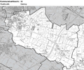
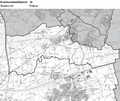
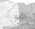
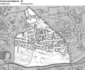
 Kommunalwahlbezirk 1 Stadt Hamm.png 855 × 716; 593 KB
-
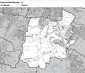
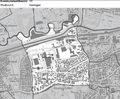
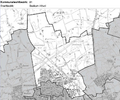
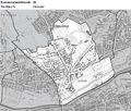
 Kommunalwahlbezirk 10 Stadt Hamm.png 864 × 723; 688 KB
-
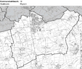
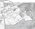
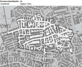
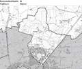
 Kommunalwahlbezirk 11 Stadt Hamm.png 849 × 732; 646 KB
-
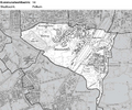
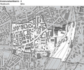
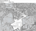
 Kommunalwahlbezirk 12 Stadt Hamm.png 855 × 720; 674 KB
-
 Kommunalwahlbezirk 13 Stadt Hamm.png 861 × 726; 653 KB
-
 Kommunalwahlbezirk 14 Stadt Hamm.png 858 × 717; 678 KB
-
 Kommunalwahlbezirk 15 Stadt Hamm.png 855 × 714; 624 KB
-
 Kommunalwahlbezirk 16 Stadt Hamm.png 858 × 723; 704 KB
-
 Kommunalwahlbezirk 17 Stadt Hamm.png 858 × 711; 654 KB
-
 Kommunalwahlbezirk 18 Stadt Hamm.png 861 × 717; 713 KB
-
 Kommunalwahlbezirk 19 Stadt Hamm.png 859 × 719; 719 KB
-
 Kommunalwahlbezirk 2 Stadt Hamm.png 858 × 714; 587 KB
-
 Kommunalwahlbezirk 20 Stadt Hamm.png 865 × 723; 688 KB
-
 Kommunalwahlbezirk 21 Stadt Hamm.png 864 × 717; 612 KB
-
 Kommunalwahlbezirk 22 Stadt Hamm.png 864 × 708; 527 KB
-
 Kommunalwahlbezirk 23 Stadt Hamm.png 861 × 729; 645 KB
-
 Kommunalwahlbezirk 24 Stadt Hamm.png 849 × 705; 642 KB
-
 Kommunalwahlbezirk 25 Stadt Hamm.png 858 × 716; 627 KB
-
 Kommunalwahlbezirk 26 Stadt Hamm.png 840 × 717; 701 KB
-
 Kommunalwahlbezirk 27 Stadt Hamm.png 858 × 711; 648 KB
-
 Kommunalwahlbezirk 28 Stadt Hamm.png 858 × 717; 613 KB
-
 Kommunalwahlbezirk 29 Stadt Hamm.png 861 × 705; 653 KB


-8.jpg)


.jpg)


.jpg)
_1.jpg)
_2.jpg)
.jpg)


.jpg)
.jpg)


.jpg)


.jpg)


.jpg)
.jpg)


.jpg)
.jpg)


